...
Description: Presents overview of European 'voyages of discovery', framing them in a search for water routes to Asia. Uses Jamestown and the instructions to the settlers to invite a driving question. (For example: Why are these instructions so specific? Why specify taking the northwest branch of a river? And what is meant by 'the other sea'?) It then moves back to discuss European contact with east Asia, using Marco Polo (but the Crusades would also be a logical point of reference). Traces efforts by Genoa, Portugal, and then Spain to locate water routes to Asia as a way of addressing the driving question (i.e., the Portuguese had found a water route south and east; the Spanish had found a route west and south; the English and others hoped to find a route west and north).
This file is pretty approximate work and contains much room for improvement! Does not include other voyages commonly included in the K-12 curriculum: Spanish intra-continental expeditions (e.g. Cortez, Pizarro, Balboa, de Leon, et al.), French explorers (Champlain, Marquette, et al.), other English expeditions (Cabot, Hudson, et al.). Other authors are invited to add these, or teachers could have their students add these as extensions to the existing file.
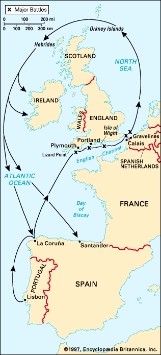
1588: Spanish Armada
SmartNotebook file developed by Tom Hammond, 2012: spanish_armada_notebook_ver02.notebook.
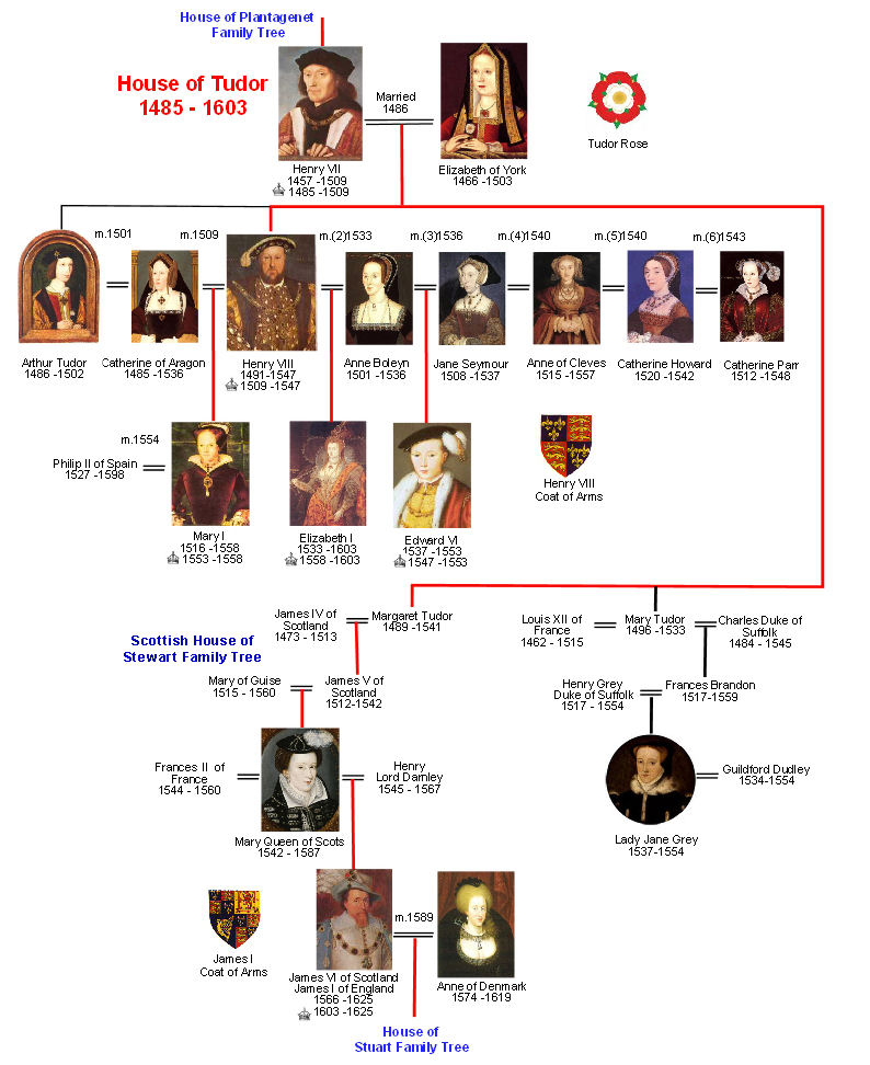
Description: Map of western Europe, plus images and diagrams to support explaining the relationships among the political leaders (i.e., marriages of Henry VIII, wedding portrait of Mary Tudor and Phillip II, etc.). Developed to for an 8th grade American History class using Prentice Hall's America, History of Our Nation. Accompanied by guided note sheet, created in ppt.
Sources consulted: Primary map is adapted from EmersonKent.com; Tudor family tree adapted from britroyals.com. Other images from Wikipedia and Britannica.
circa 1600: European Religions
...